When dense tree cover, steep canyons, or unfamiliar terrain kill your cell signal, a dedicated ATV GPS unit becomes the single most important piece of gear on your machine. These devices are built to withstand vibration, mud, and water while providing reliable navigation where consumer phones fail.
I’m Min — the co-founder and writer behind Gadgets Feed. For this guide, I spent countless hours cross-referencing satellite support, battery life in real-world conditions, and the durability specs that actually matter when you’re miles from pavement.
After digging through technical datasheets, customer test logs, and trail reports, I’ve assembled the definitive list of the best atv gps unit options available today across every meaningful price tier.
How To Choose The Best ATV GPS Unit
An ATV GPS unit is a rugged, off-road navigation tool, not a car GPS. Choosing one requires balancing satellite reception, map detail, and physical durability against the unique conditions of trail riding, where mud, vibration, and tree canopy are constants.
Satellite Support: The Reception Foundation
Standard GPS alone can lose lock under thick foliage or in steep terrain. Units supporting multi-band GNSS (GPS, GLONASS, Galileo) provide faster fixes and more stable position tracking. The Garmin GPSMAP 65 and Montana 700 leverage this for sub-10-foot accuracy in challenging locations.
Screen Readability and Size
A 2.2-inch screen like the eTrex 32x is ultra-portable but demands close attention while riding. Larger displays, such as the 5-inch Montana 700, offer better glanceability but require substantial handlebar mounting. Sunlight-readable transreflective screens are non-negotiable for daytime trail use.
Durability and Power Management
IPX7 waterproofing ensures survival through creek crossings and rain. MIL-STD-810 certification adds shock and vibration protection for rough trails. Battery strategy is equally critical—replaceable AA batteries (eTrex 32x, GPSMAP 65) let you carry spares deep in the woods, while internal rechargeables (Montana 700) require USB power availability.
Quick Comparison
On smaller screens, swipe sideways to see the full table.
| Model | Category | Best For | Key Spec | Amazon |
|---|---|---|---|---|
| Garmin Montana 700 | Premium Handheld | Serious trail navigation | 5″ glove-friendly touchscreen / 18hr battery | Amazon |
| Garmin GPSMAP 65 | Premium Handheld | Multi-band accuracy | 2.6″ color display / 16hr battery | Amazon |
| Garmin Foretrex 801 | Wrist-Mounted | Minimalist wrist navigation | 100hr battery life / Multi-band GNSS | Amazon |
| MUNBYN ILT02 Tablet | Rugged Tablet | Large-screen off-road nav | 11″ / IP68 / 10000mAh battery | Amazon |
| Garmin eTrex 32x | Mid-Range Handheld | Budget-friendly reliability | 2.2″ display / 25hr battery (AA) | Amazon |
| Garmin DriveSmart 76 | Car GPS | Side-by-side road routing | 7″ high-res / Voice Assist | Amazon |
| Garmin DriveCam 76 | Premium Car GPS | Navigation with dash cam | 7″ / Built-in dash cam / Incident detection | Amazon |
| Rand McNally RANDTAB7 | Truck Navigator | Heavy-duty overland rigs | 8″ display / Truck-specific routing | Amazon |
| Garmin RV 895 | RV Navigator | Large vehicle trail access | 8″ screen / Custom RV routing | Amazon |
In-Depth Reviews
1. Garmin Montana 700

The Montana 700 represents the sweet spot for ATV riders who demand a large, glove-friendly touchscreen without sacrificing ruggedness. Its 5-inch WVGA transflective display is 50% larger than the previous model, making trail maps readable at a quick glance while bouncing over ruts. The MIL-STD-810 rating for thermal, shock, and vibration solidifies its position as a machine built for handlebar mounting.
Multi-GNSS support covers GPS, GLONASS, and Galileo, ensuring stable position tracking even when you’re threading through a dense canyon. The 3-axis compass and barometric altimeter provide elevation and heading data independent of movement, critical for dead-reckoning when you stop to read a trail junction. With 18 hours of battery life from the included lithium-ion pack, it lasts a full day of aggressive riding.
Wireless connectivity via ANT+, Bluetooth, and Wi-Fi enables direct BirdsEye Satellite Imagery downloads and compatibility with the Garmin Explore app for trip management. The touchscreen works with gloves on, eliminating the need to bare fingers in cold weather. A microSD slot expands storage for additional topo maps and custom trail data.
Why it’s great
- Large 5-inch screen works with gloves and in direct sunlight
- Multi-GNSS with ABC sensors for reliable trail awareness
- MIL-STD-810 rated for vibration and shock on rough terrain
Good to know
- Uses internal lithium battery—no AA backup option without optional adapter
- Preloaded topo maps may lack high-detail contour lines for serious hunting
2. Garmin GPSMAP 65

The GPSMAP 65 is the accuracy king of this lineup, thanks to its expanded GNSS support and multi-band frequency technology. In challenging environments—steep country, urban canyons, and forests with dense trees—the 65 locks onto satellites faster and maintains a sub-10-foot accuracy reading where single-band GPS units drift. This matters deeply when you’re navigating unmarked cutlines and need to pinpoint a specific ridge crossing.
The 2.6-inch sunlight-readable color display is driven by physical buttons, not a touchscreen. That is a deliberate advantage in wet, muddy, or gloved conditions where capacitive screens become unusable. The button interface also allows one-handed operation while keeping your other hand on the bars. Preloaded TopoActive maps with federal public land boundaries give immediate awareness of property lines and restricted zones.
Battery life ranges from 10 to 27 hours depending on satellite mode, and the unit runs on standard AA batteries. Carrying a spare set of lithium AAs in your pack effectively extends navigation time to multiple days without power access. Bluetooth connectivity provides smart notifications from your phone and compatibility with the Garmin Explore ecosystem for route planning and data syncing.
Why it’s great
- Multi-band GNSS delivers exceptional accuracy under heavy canopy
- Physical buttons work perfectly with wet or muddy gloves
- AA batteries allow infinite backup without charging infrastructure
Good to know
- Garmin’s BaseCamp software has a steep learning curve for map management
- Screen is small (2.6″) compared to touchscreen options
3. Garmin Foretrex 801

The Foretrex 801 takes the ATV GPS concept and straps it to your wrist, making it ideal for riders who don’t want a bulky screen cluttering their handlebars. Its monochromatic LCD screen is exceptionally readable in all lighting conditions, including direct sunlight and through night vision goggles. The wrist-mount format keeps navigation data in your peripheral vision without requiring you to look down at a handlebar mount constantly.
Upgraded multi-band GNSS reception provides the same position accuracy as the larger GPSMAP 65, but in a package that weighs almost nothing. The 100-hour battery life on a single pair of AA batteries is best-in-class for this category—you can ride an entire multi-day expedition without changing power cells. Advanced sensors include a 3-axis accelerometer, compass, and barometric altimeter for full environmental awareness.
Stealth mode and a kill switch for erasing device memory make the Foretrex 801 suitable for backcountry security scenarios. It pairs with the Garmin Explore app for route planning and with inReach satellite communicators for two-way messaging. The included hook-and-loop strap secures to your wrist or can be wrapped around a handlebar if you prefer a fixed mount.
Why it’s great
- 100-hour battery life from two AA batteries is unmatched
- Wrist mount keeps navigation always visible without handlebar clutter
- Multi-band GNSS accuracy in an ultra-lightweight package
Good to know
- Monochrome screen lacks color topo map detail of larger units
- Small form factor means less data shown on screen at once
4. MUNBYN ILT02 11-Inch Rugged Tablet
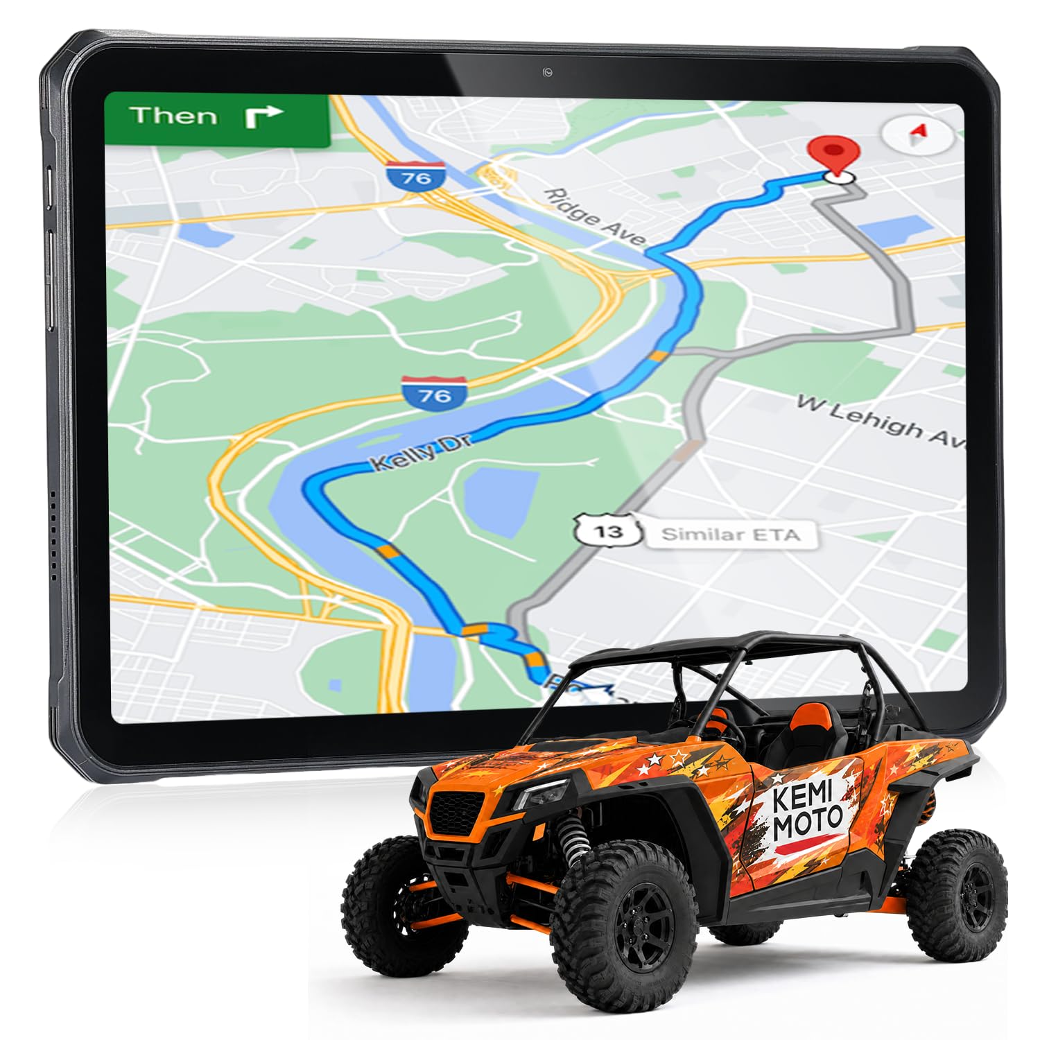
For riders who want the largest possible map view, the MUNBYN ILT02 delivers an 11-inch IPS display with 1200×1920 resolution, turning your handlebar area into a full navigation dashboard. The 10,000mAh battery with 33W fast charging reaches 76% in 60 minutes, enough to power through a full day of trail riding with GPS-intensive mapping apps like OnX Offroad or Polaris Ride Command running continuously.
IP68 waterproofing means the tablet survives full submersion in 1 meter of water for 30 minutes, and MIL-STD-810H certification covers drops from 1.2 meters onto concrete. The Mediatek 8781 processor with 16GB of RAM (8GB physical + 8GB virtual) handles multitasking between navigation, music streaming, and trail recording without lag. The 48MP rear camera can document trail conditions or incident details in clear resolution.
It runs Android 14, giving you access to the full Google Play Store for mapping apps. The 4G LTE connectivity works with data SIMs for live traffic and weather overlays, and GPS functions operate independently without a SIM card. Note that the tablet ships without pre-installed GPS software—you’ll need to download your preferred navigation app from the Play Store before heading out.
Why it’s great
- 11-inch screen provides the largest map view for off-road navigation
- IP68 and MIL-STD-810H ratings handle mud, water, and drops
- 10,000mAh battery with fast charging supports extended trail days
Good to know
- Requires mounting system for handlebar placement
- No pre-installed GPS software; needs app download before use
5. Garmin eTrex 32x

The eTrex 32x is the entry-level powerhouse that proves you don’t need to spend premium money for reliable trail navigation. Its 2.2-inch sunlight-readable color display packs 240×320 pixels, enough to distinguish trail forks and waypoints without straining. The GPS and GLONASS satellite support provides better coverage than GPS-only units, particularly in northern latitudes where GLONASS satellites offer stronger overhead coverage.
The 3-axis compass and barometric altimeter are rare features at this price point. The compass provides accurate headings without requiring movement, and the altimeter tracks elevation changes precisely—useful for identifying ridge lines and valley floors on topo maps. Preloaded TopoActive maps include routable roads and trails for both cycling and hiking, giving you immediate overhead orientation without downloading additional data.
Up to 25 hours of battery life from two AA batteries makes the eTrex 32x a cost-effective companion for multi-day trips. The 8GB of internal memory handles map downloads, and the microSD card slot expands storage for more detailed regional topo maps. Physical buttons are ideal for cold-weather use where touchscreens fail, and the compact form factor fits easily into a jacket pocket when not mounted.
Why it’s great
- Excellent battery life (25hr) with cheap, replaceable AA batteries
- 3-axis compass and barometric altimeter at an attainable price
- Compact and rugged with physical buttons for cold/wet conditions
Good to know
- Small 2.2-inch screen requires closer attention than larger units
- Screen refresh lag can be noticeable when panning maps
6. Garmin DriveSmart 76

The DriveSmart 76 is primarily a car GPS, but its 7-inch high-resolution touchscreen and powerful routing engine make it an excellent choice for side-by-side UTV riders who need both paved road navigation and trail system access. The capacitive touchscreen is responsive and fast, with “OK Garmin” voice assist that lets you set destinations without taking your gloves off. Live traffic and weather data stream through the Garmin Drive app on your paired smartphone.
Preloaded with North America maps, the DriveSmart 76 includes a directory of national parks, Tripadvisor ratings, and Foursquare POIs, making it easy to find gas stations, food, and campgrounds near trailheads. The dual USB charger in the box provides an extra charging port for your phone or action camera, a thoughtful addition for long trips where power management matters.
Wi-Fi connectivity enables map and software updates without a computer, so your trail and road data stays current. The vehicle suction cup mount is designed for windshields, but on a UTV, it can be adapted to a flat dash surface. Battery life is limited to roughly one hour, so the DriveSmart 76 must stay plugged into vehicle power during use.
Why it’s great
- Large 7-inch screen with responsive touch and voice control
- Live traffic, weather, and fuel prices via smartphone pairing
- Wi-Fi updates and dual USB charger included
Good to know
- Not built for handlebar mounting—suction cup mount suited for windshields
- Short internal battery requires constant vehicle power connection
7. Garmin DriveCam 76

The DriveCam 76 combines Garmin’s proven 7-inch navigation platform with a built-in dash camera, recording your route while you follow turn-by-turn directions. The dash cam stores video on a pre-installed 16GB microSD card and automatically uploads incident clips to the secure Garmin Vault via the Drive app—valuable for documenting trail encounters or road incidents during transit between trailheads.
Forward collision and lane departure warnings add an extra layer of safety for highway stretches between trail systems. Driver alerts for school zones, sharp curves, and speed changes keep you aware of changing road conditions. The Birdseye satellite imagery provides an aerial perspective of campgrounds and trailhead parking areas, helping you pick the best spot to unload your ATV.
Voice assist allows hands-free destination entry, and the Bluetooth hands-free calling keeps you connected without taking your hands off the steering wheel. Wi-Fi connectivity simplifies map updates. The DriveCam 76 is best suited for UTVs or trucks towing ATVs where you want a single device handling both navigation and recording.
Why it’s great
- Built-in dash cam with incident detection and cloud backup
- Large 7-inch display with premium voice assist features
- Forward collision and lane departure warnings for highway travel
Good to know
- Dash cam functionality may have legal restrictions in some jurisdictions
- Limited to ~1 hour battery life; must remain plugged into vehicle power
8. Rand McNally RANDTAB7
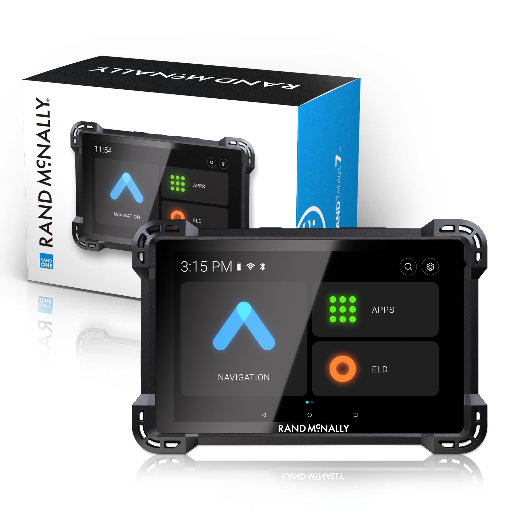
The Rand McNally RANDTAB7 is built for heavy-duty overland rigs and large utility vehicles that tow ATVs to remote trailheads. Its 8-inch touchscreen runs Rand Navigation 2.0 software with 2025-edition maps, providing custom truck routing based on your vehicle’s height, weight, width, axle count, and hazmat type. This ensures you don’t get squeezed under a low bridge or routed down a residential road with your ATV trailer in tow.
Real-time traffic, weather, fuel price alerts, and speed camera warnings keep your journey efficient and legal. The built-in camera allows image capture for documenting load conditions or trailhead locations. The powered magnetic mount and reinforced power cable with both USB-C and barrel connectors provide a secure, vibration-resistant mounting solution for rough roads.
POI warnings cover weigh stations, steep curves, engine brake restrictions, narrow roads, construction zones, and speed limit changes—critical when navigating a truck and trailer combination toward ATV access points. Battery life is approximately 5 hours, so keeping it plugged into the vehicle’s power is recommended for long travel days.
Why it’s great
- Custom routing based on vehicle height, weight, width, and hazmat
- 8-inch bright display with powerful magnetic mount for vibration resistance
- Warnings for low bridges, steep grades, and restricted roads
Good to know
- Some users report GPS signal loss in clear conditions
- Routing options can be inflexible for alternate route selection
9. Garmin RV 895

The Garmin RV 895 is the ultimate navigator for RV owners who haul their ATVs to destination trails. Its 8-inch high-resolution touchscreen can be viewed in landscape or portrait orientation, giving you flexible mounting options in the cab. Custom routing based on your RV’s height, weight, and length keeps you off roads with clearance issues or weight restrictions, protecting both your vehicle and your ATV cargo.
The preloaded directory of RV parks, services, and public campgrounds includes content from KOA, Ultimate Public Campgrounds, and PlanRV, making it easy to find overnight spots near ATV trail systems. Tripadvisor traveler ratings and Foursquare POIs help you assess campground quality before you arrive. Birdseye satellite imagery shows aerial views of campground layouts and trailhead parking areas.
Road warnings for steep grades, sharp curves, and weight limits keep you aware of upcoming conditions while towing. The Garmin Drive app provides real-time weather overlays and parking availability at Pilot Travel Centers and Love’s Travel Stops. Battery life is roughly 2 hours, so the RV 895 requires constant vehicle power—standard practice for RV installations.
Why it’s great
- 8-inch high-resolution screen with landscape or portrait viewing
- Custom RV routing prevents low-bridge and weight-limit issues
- Preloaded RV park directory with campground content and reviews
Good to know
- Large physical size may be difficult to mount in smaller cabs
- Some users report routing quirks that require sanity-checking the route
FAQ
Is a car GPS good enough for ATV trail riding?
Do I need preloaded topo maps or can I download them later?
Final Thoughts: The Verdict
For most riders, the best atv gps unit winner is the Garmin Montana 700 because it balances a large glove-friendly 5-inch touchscreen with MIL-STD-810 ruggedness and multi-GNSS accuracy that handles any trail condition. If you prioritize sub-10-foot positional accuracy and the ability to carry spare AA batteries for multi-day expeditions, grab the Garmin GPSMAP 65. And for riders who want the largest possible map view in a fully waterproof package, nothing beats the MUNBYN ILT02 Rugged Tablet.